
(Before reading, I suggest downloading the free app Mars Globe as a reference. Since Mars has a readily visible surface, most of the features have been named. The app will help keep track of them.)
Looking down from the caldera peak of Olympus Mons, you wouldn’t even see the ground. Or, rather, you wouldn’t see anything other than the gently curving slope of the mountain. Standing 14 miles high, Olympus Mons’ 370 mile-wide base disappears beyond Mars’ short horizon. It is more than twice as tall as Mauna Kea and roughly the size of France. In many ways, it is similar to the volcano that forms the largest Hawaiian island. Both are very large shield volcanoes, which are much wider than they are tall due to low-viscosity (not sticky) lava flowing further from the peak. They both formed over hot spots in the mantle that, over time, built up to their great heights. On Mars, there is no tectonic activity to spread its height over an island chain. Thus, Olympus Mons grew over the ages, spreading wider and wider until Mars cooled enough to stop it.

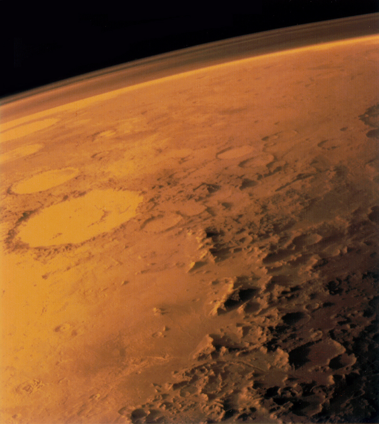
Wispy atmosphere over the wide plain surrounding Olympus Mons (via Imgur)
Nearly directly opposite Olympus Mons rests the easily visible Hellas impact basin. The basin is the deepest point on Mars, four and a half miles below the datum (an agreed upon reference height). Such a large impact is thought to have caused the hotspot to form under Olympus Mons. The hotspot, over eons of volcanic activity, caused a large, uplifted region, called Tharsis, to form. In addition to Olympus Mons, three other large volcanoes, the Tharsis Montes, formed in a line at the mouth of an immense canyon. It is Valles Marineris, the largest canyon system in the solar system. If placed on the United States, it would stretch all the way from New York to Las Vegas, which, on Mars, is almost one-quarter of the way around the planet. So when the large impact excavated Hellas Planitia, it sent energy through the planet, where it caused a hot spot on the opposite side. Up rose Tharsis, and the massive change in Mars’ surface split it wide open, forming massive volcanoes that poured lava onto the surrounding plane. That put more stress on the canyon, which continued to grow and split for a couple billion years.

A simulated low-angle image of Valles Marineris with the Tharsis volcanoes in the background (Olympus is second from right)
Still on the southern hemisphere, but around the other side of the planet, is a similar, though smaller, impact crater known as Argyre. It is about half as wide and deep as Hellas but also caused a volcanic uplift. Opposite Argyre on the globe is a lump of volcanoes known as Elysium. Elysium isn’t as extensive as the Tharsis volcanoes, but it is a prominent feature in the otherwise uniform northern hemisphere.
A low angle image of the Martian atmosphere over the edge of the Argyre basin. Galle crater is in the foreground (via Wikimedia Commons)
The uniformity of the northern hemisphere is striking considering the jumbled and cratered terrain of the southern hemisphere (and most of the rest of the solar system). Save for a few fairly new craters, the Martian north is a vast, flat plain that sits about a mile lower than the other two-thirds of the planet. On the other side, the Martian south is extensively pock-marked and broken, and it sports a thicker crust than the north by more than 15 miles. The two regions straddle the equator; they would be equally sized if not for Tharsis forming and spilling into the northern plains, becoming part of the highlands. The cause is not entirely confirmed, but a prevailing theory is a large impact struck an early Mars near its pole and obliterated half of the crust.
_with_poles_HiRes.jpg)
An equatorial and polar topographic map highlighting the difference in hemisphere (via Wikimedia Commons)
Covering all of this chaotic terrain is a very thin atmosphere of mainly carbon dioxide. It is only 0.6 percent that of Earth’s and comparable to the pressure higher than 120,000 feet above sea level (Mt. Everest is 29,029 feet tall, for reference). Earth has such a thick atmosphere due to its larger gravity, which can hold onto the gas more easily. Another reason is its magnetic field. Earth has a molten core of iron and nickel that spins as Earth turns. The spin produces the magnetic field that protects its atmosphere from being stripped away by the solar wind. Mars has little surface gravity and does not have a molten core to produce a magnetic field, so its atmosphere is left unprotected and is easily lost. Another reason Mars has a thin atmosphere is that during the winter season, as caused by its 25-degree axial tilt, some of the CO2 actually freezes onto the surface. It can lose a quarter of its “air” pressure in this way. More than that, there is also a fair amount of water vapor in the atmosphere (it should be noted that “fair” is a relative term. Mars is, on the whole, even drier than Antarctica). During winter, this vapor also freezes out as an ice cap, though this time on the northern pole. The southern pole is predominantly dry ice, while the northern cap is mostly ice with a dusting of CO2 in the winter.
Speaking of water, while Mars is now very arid, there are many features of significant water movement. North of Valles Marineris, there is a system of valleys named Kasei Valles, which were carved out into a sinuous pattern indicative of a river’s outflow. At some point in Mars’ history, a large amount of water flowed down from the Tharsis bulge, meandered to the north and moved into the lowlands in the northern hemisphere. The channel splits and curves past a teardrop-shaped plateau and eventually empties into the basin known as Chryse Planitia. Many models of a terraformed Mars put a world-wide ocean in the northern basins, which would follow from this (and other) ancient river outflows leading from the higher southern hemisphere to the lower north. Where all this water is now is up to some speculation. A current theory is it is locked under the surface in massive ice aquifers, waiting for warmth or an impact to release it back onto the surface.
.jpg)
The curving system of Kasei Valles, formed by ancient Martian waters (via Wikimedia Commons)


